
 Here are the details of maps for Cirencester & Preston:

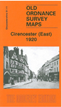
This detailed map is one of a pair of maps for Cirencester. It covers the eastern half of the town, with coverage stretching from the east end of Market Place eastward to Kingshill Lane and beyond. Partb of Preston village, including All Saints church, is in the SE corner. A major aspect of the map is the Watermoor area, where features include the Midland & South Western Junction Railway with station and engine house. Other features include Trinity church, Watermoor House, Poor Law Institution, Royal Nursery, Dyer Street, Victoria Road, Watermoor Road, Tower Street, The Avenue, Lewis Lane, The Beeches, Golden Farm, isolation hospital, Preston Forty. On the reverse we include extracts from an 1894 directory, including Commercial entries J-Z. On the reverse we include a commercial directory from 1894, entries A-I and a 1906 timetable for the GWR's Cirencester Branch.
The map links up with a map for Cirencester West.
Maps in the Godfrey Edition are taken from the 25 inch to the mile map and reduced to about 15 inches to the mile. For a full list of maps for England, return to the England page.
Alan Godfrey Maps, Prospect Business Park, Leadgate, Consett, Co Durham, DH8 7PW / sales@alangodfreymaps.co.uk / 28 October 2016