
 Here are the details of maps for Dundee (East):

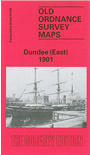
This detailed map covers the eastern half of Dundee, with coverage stretching from Brown Constable Street eastward to the Eastern Necropolis, and from Sandeman Street southward to Victoria Dock.
Features include Victoria Dock, Camperdown Dock, Caledon Shipbuilding Yard, railway approaches from east, Camperdown Shipbuilding Yard, Dundee Fish Depot, Eastern Necropolis, St Patrick's RC church, Manhattan Works, Poorhouse, Stobswell Works, Baxter Park, Fourth Ward area, First Ward area, Cattle Market, Taybank Works, East End Mineral Depot, Morgan Academy, Parochial Hospital, Greendykes, Craigie Bank, bathing ponds, tramways etc. On the reverse we include street directory entries for Albert Street, Arbroath Road, Baffin Street, Baxter Park Terrace, Dock Street, Park Avenue.
The map links up with Forfarshire sheet 54.05 Dundee West to the west.