Old Ordnance Survey Maps of Angus

  • These detailed maps normally cover an area of about one and a half miles by one mile. Each map includes an introduction.
  • They are available through our On-line Mapshop

  • Here are the details of maps for Arbroath (S):

  • Forfarshire Sheet 46.15 Arbroath (South) 1901 - published 1992; intro by Margaret King. ISBN.978-0-85054-514-2

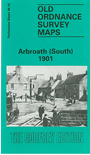
    This detailed map covers the southern half of Arbroath, with coverage stretching from Spink Street and Hume Street southward.

    Features include railway approaches from south and station, Harbour, Keptie Street area, High Street area, Marketgate, much of town centre with individual buildings neatly shown, Wet Dock, Tidal Harbour, football ground, Kirk Square, Custom House, Dishland Hill, boot factory, Infirmary, High Common. Low Common, Cannon Common, West Common, High School, water tower, Ladies Bathing Pavilion, etc.

    The map links up with Forfarshire sheet 46.11 Arbroath North to the north


  • Follow this link for a complete list of our Angus & Dundee maps.
  • You can order maps direct from our On-line Mapshop. For other information and prices, and other areas, go to The Index Page.
  • Maps in the Godfrey Edition are taken from the 25 inch to the mile map and reduced to about 15 inches to the mile. For a full list of maps for Scotland, return to the Scotland page.
    The Godfrey Edition / sales@alangodfreymaps.co.uk / 19 Nov 2016