Old Ordnance Survey Maps of Fordingbridge


We have published more than 1,900 maps in our series of Old Ordnance Survey Map reprints, including groups in Hampshire and Wiltshire. The maps are highly detailed. They are taken from the OS 1:2,500 (or 25 inch) maps and reduced to about 15 inches to the mile. Each covers an area of a mile and a half by a mile. They show streets with individual houses, tram tracks, railway tracks and even signals, factories, wharves and such details as fountains and water troughs. They will provide hours of fascination for historians and genealogists. The maps are neatly folded and each includes a specially written introduction to the area. Maps can be purchased on our On-line Mapshop where further information about titles is given. Or visit The Index Page for a full list to the series and details of Prices.


Here are the details of maps for Fordingbridge:

  • Hampshire Sheet 62.03 Fordingbridge 1896 - published 1997; introduction by Alan Godfrey. ISBN 0-85054-884-5

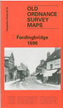
    This detailed map covers the little town of Fordingbridge, whose population had scarcely risen during the 19th century and stood at 3,162 in 1901 (though many of these lived outside the town itself). Our map covers the town centre and extends west to the station, Ashford Vineyard and Perry Farm. Features include Farinaceous Food Factory, Packham House, Oaklands, Parsonage Farm, High Street, Market Place, Town Mill, Salisbury Street, Bridge Street, Workhouse, brewery, Horseport, Burgate House. On the reverse we include a small extract from sheet 62.07 and this extends coverage south to the church. A directory of 1899 is also included. Surprisingly Fordingbridge had its own small slum, where tenements were "barely habitable, and the occupiers the 'scum' of the parish". Fordingbridge is sometimes thought to be the Silverbridge of Trollope's Barchester novels.


    Follow this link for a complete list of our Hampshire Series maps.

    You can order maps direct from our On-line Mapshop. For other information and prices, and other areas, go to The Index Page.


    Maps in the Godfrey Edition are taken from the 25 inch to the mile map and reduced to about 15 inches to the mile. For a full list of maps for the South West, return to the South West page.

    The Godfrey Edition / godfreyedition@btinternet.com / 14 February 2006