
Old Ordnance Survey Maps of Fife
This page summarises the local government organisation of Fife since 1890.
 Fife, sometimes called the Kingdom of Fife, was one of Scotland's historic counties in 1890.
Unlike most Scottish counties it has hardly been changed, becomimng a region and then a unitary council. There was minor alteration to
boundaries in 1890.
Fife, sometimes called the Kingdom of Fife, was one of Scotland's historic counties in 1890.
Unlike most Scottish counties it has hardly been changed, becomimng a region and then a unitary council. There was minor alteration to
boundaries in 1890.
Fife had a large number of burghs. These were the royal burghs in 1890: Anstruther Easter*, Anstruther Wester*, Auchtermuchty, Burntisland, Crail,
Culross, Cupar, Dunfermline, Dysart, Earlsferry*, Falkland, Inverkeithing, Kilrenny*, Kinghorn, Kirkcaldy, Newburgh, Pittenweem,
St Andrews.
These were the ordinary burghs in 1890: Buckhaven & Methil, Cowdenbeath, Elie*, Ladybank, Leslie, Leven, Lochgelly, Markinch,
Newport-on-Tay, Tayport.
The burghs marked * were merged in 1929 with new royal burghs of Kilrenny, Anstruther Easter & Anstruther Wester; and Elie & Earlsferry.
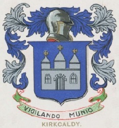
Kirkcaldy absorbed Dysart in 1930.
St Monance became a burgh in 1933.
In 1975 there was major reorganisation as the counties were abolished and replaced by 12 Regions. Fife became a region.
Beneath the region in a two-tier structure were 3 Districts: Dunfermline., Kirkcaldy, and North East Fife.
In 1996 there was further reorganisation as the Regions and Districts were abolished and replaced by 32 unitary councils. Fife then became a unitary council.
There are 3 management areas covering similar areas to the former districts: Dunfermline & West Fife, Kirkcaldy & Mid Fife, and St Andrews & East Fife.
For a list of Fife maps go to the Fife page.
For a full list of Scottish maps, return to the Scotland page
You can order maps direct from our On-line Mapshop.
Minor changes are not listed here, but please advise us of any significant errors or omissions.
Alan Godfrey Maps, Prospect Business Park, Leadgate, Consett, DH8 7PW. Tel 01207 583388
The Godfrey Edition / sales@alangodfreymaps.co.uk / 18 November 2016