Old Ordnance Survey Maps of London

  • These detailed maps maps normally cover an area of about one and a half miles by one mile. Each map includes an introduction. The Essex maps link up with those for London to form a major series for the Greater London area. They are available through our On-line Mapshop

  • Here are the details of maps for Woodford:

  • Essex (New Series) 69.14 Woodford Wells 1914 - published 2008; introduction by Alan Godfrey

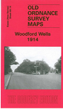
    This detailed map covers the northern part of Woodford, including Woodford Wells and much of Woodford Green. Features include Little Monkhams, Monkhams (here shown as St Thomas High School), Hart House, Union Church, railway with Woodford Junction, Knighton Wood, Bancroft's School, Knighton, All Saints church, Monkhams Farm etc. On the reverse we include a commercial directory of Woodford Wells.

    The map links up with Essex Sheet 69.10 Buckhurst Hill to the north, 69.13 Chingford Hatch to the west and 78.02 Woodford to the south.


    Follow this link for a list of our maps for the London Borough of Waltham Forest, or here for a complete list of our 'Essex-in-London' maps .

    You can order maps direct from our On-line Mapshop. For other information and prices, and other areas, go to The Index Page.


    Maps in the Godfrey Edition are taken from the 25 inch to the mile map and reduced to about 15 inches to the mile. For a full list of maps for England, return to the England page.

    Alan Godfrey Maps, Prospect Business Park, Leadgate, Consett, Co Durham, DH8 7PW / godfreyedition@btinternet.com / 29 July 2011