Old Ordnance Survey Maps of Chelmsford


We have published more than 2,100 maps in our series of Old Ordnance Survey Map reprints, some 30 of them in the Essex area. The maps are highly detailed. They are taken from the OS 1:2,500 (or 25 inch) maps and reduced to about 15 inches to the mile. They show streets with individual houses, tram tracks, railway tracks and even signals, factories, wharves and such details as fountains and water troughs. They will provide hours of fascination for historians and genealogists. The maps are neatly folded and each includes a specially written introduction to the area. Maps can be purchased on our On-line Mapshop where further information about titles is given. For other information and Prices, see Index Page.


Here are the details of maps for Chelmsford:

  • Essex (New Series) Sheet 54.15 Chelmsford 1919 - published 2008; introduction by Harry Carmichael

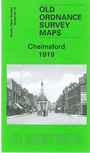
    This detailed map covers central Chelmsford and the area eastward to Barnes Lock and Barnes Mill, southward to Whitehouse Farm. Features include Cathedral, station (top left corner), St John's church, Mesopotamia Island, Cattle Market, Stone Bridge, Shire Hall, Tindal Square, River Chelmer, Moulsham Mill, Chelmer & Blackwater Canal, Holy Trinity church, etc. On the reverse we include the list of Private Residents from a 1922 directory.


    Follow this link for a complete list of our Essex countty maps or here for our London maps.

    You can order maps direct from our On-line Mapshop. For other information and Prices, see Index Page.


    Maps in the Godfrey Edition are taken from the 25 inch to the mile map and reduced to about 15 inches to the mile. For a full list of maps for East Anglia, return to the East Anglia page.

    The Godfrey Edition / godfreyedition@btinternet.com / 25 January 2008