
 Here are the details of maps for Edinburgh (West):

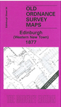
This wonderfully detailed map covers an area from Lansdowne Crescent eastward to Cambridge Street, and from Melville Street southward to Tobago Street. Features include Princes Street station with approaches and Goods Station, St Mary's Cathedral, tramways, Royal Edinburgh Theatre, Hay Market (Haymarket station is partly shown in SW corner), Maitland Street area, St Cuthbert's church, St John's Chapel, St David's Free Church, west end of Princes Street etc.
The map links up sheet 28 Dean Village to the north, 35 Edinburgh Castle to the east, and 33 Wester Coates to the north and 38 Fountainbridge to the south.