Old Ordnance Survey Maps of Edinburgh

  • These detailed maps normally cover an area of about one and a half miles by one mile. Each map includes an introduction.
  • They are available through our On-line Mapshop

  • Here are the details of maps for Corstorphine:

  • Edinburghshire Sheet 3.09 Edinburgh (Holyrood) 1984 - published 1996; intro by Barbara Morris. ISBN.978-0-85054-841-9

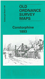
    This detailed map covers the village of Corstorphine, just west of Edinburgh.

    Features on this map include NBR railway with Corstorphine station, Broom House, Corstorphine village, Dunsmure, churches, Convalescent Hospital, South Gyle, The Stank. There was little development in the area at the time. On the reverse we include a small section of the 1905 revision of this map, which shows St Anne's church and the railway terminus in Corstorphine.

    The map links up with Edinburgh Sheets 3.10 Gorgie to the east.


  • Follow this link for a complete list of our Edinburgh maps.
  • You can order maps direct from our On-line Mapshop. For other information and prices, and other areas, go to The Index Page.
  • Maps in the Godfrey Edition are taken from the 25 inch to the mile map and reduced to about 15 inches to the mile. For a full list of maps for Scotland, return to the Scotland page.
    The Godfrey Edition / sales@alangodfreymaps.co.uk / 29 October 2016