 Here are the details of maps for Dumfries (S):

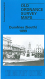
This detailed map covers the southern part of Dumfries, with coverage stretching from Queensberry Square southward to Castledykes and the Comyn's Castle site; and from the New Bridge eastward to Noblehill.
Features include stretch of GSWR railway with Goods Station, Mount St Michael RC College, Dumfries & Galloway Infirmary, Castledykes, Westfield area, Nithsdale Mills, River Nith, High Street and town centre with individual buildings neatly shown, St Michael's church, St Andrew's RC Pro Cathedral, Cattle Market, Old Bridge. A small section of Maxwelltown, in Kirkcudbrightshire, is shown on the west bank of the Nith, including Troqueer Mills, Troqueer Holm, West Park, Corbelly Hill Nursery. On the reverse we include a selection of street directory entries, including Bank Street, Broom's Road, English Street, Friars Vennel, Nithbank, Shakespeare Street.
Dumfries received a charter as a burgh in 1184, the town having developed at the lowest crossing point on the River Nith. Robert Burns came to live here in 1791 and another author was J M Barrie, who studied at the Academy. During the 19th century it became an important mill town. A suspension bridge was built in the 1870s to help the millworkers get to work, but turnstiles had to be added as the bridge swung from side to side - just like London's Milennium Bridge. It also became a major railway junction.
The map links up with Dumfriesshire sheet 49.15 Dumfries North to the north.