 Here are the details of maps for Denbigh:

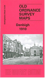
This detailed map covers the town of Denbigh, in the 16th century virtually the capital of NE Wales, and described by Leland as having a market "which is fayre, and large, and paved of late yeares, the confluence to the market on Tewesday is exceding great". However, the town declined in importance in the 19th century with the rise of Wrexham. Our map covers most of the town, and features include the town centre, Castle, Howells School, St David's church, Copenhagen, Lenten Pool, Graig Quarry and siding, Fron, infirmary, Alafowlia, railway and station, High Street, St Hilary's church, Borough Market. On the reverse we include an "Alphabetical list of Private Residents, Traders and Others" from an 1890 directory.