
 Here are the details of maps for Gunnislake (N):

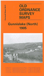
This detailed map is one of two we have published for the village of Gunnislake. This covers the northern part of the village, from St Anne's church northward, including the adjacent hamlets of Middle Dimson, Lower Dimson and North Dimson. Coverage extends eastward to Hatchwood, Luscombedown Plantation and Gulworthy Farm (which is split by the extreme right margin). Northward are Hangingcliff Wood and part of Blanchdown Wood. Features on the map include the disused Plymouth Works, disused South Bedford mine, Gunnislake Clitters Mine (at left margin), Bedford United Mine, Hawkmoor Mine, Watson's Mine, Bedford United Mine, several old shafts, also the route of an already abandoned railway to Watson's Mine and other workings. On the reverse we include a 1910 directory.
The map links up with Sheet 30.05 Gunnislake South to the south.