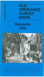
Cornwall Sheet 10.07 Boscastle 1905 - published 2006; intro by Tom Greeves. ISBN 978-1-84151-893-0 
This detailed map covers much of the village of Boscastle, where the River Valency runs into the sea. Coverage stretches from Penally Point eastward to Minster Wood, and from
the northern tip of High Street northward to Pentargon. Features include Penally House, Napoleon Inn, Bottreaux Castle, Boscastle Harbour, Fore Street, Dunn Street, New Road,
Ship Inn, Forrabury Comnmon. St Symphorian's church Forrabury, Western Blackapit. On the reverse we include a 1910 directory.
Follow this link for a list of our maps for Cornwall or here for a general list for the South West.
You can order maps direct from our On-line Mapshop.
For other information and prices, and other areas, go to The Index Page.
Maps in the Godfrey Edition are taken from the 25 inch to the mile map and reduced to about 15 inches to the mile.
For a full list of maps for England, return to the England page.
Alan Godfrey Maps, Prospect Business Park, Leadgate, Consett, Co Durham, DH8 7PW / sales@alangodfreymaps.co.uk / 13 January 2018

 Here are the details of maps for Boscastle & Forrabury: