Old Ordnance Survey Maps of Cheshire


  • These detailed maps normally cover an area of about one and a half miles by one mile. Each map includes an introduction.
  • They are available through our On-line Mapshop

  • Here are the details of maps for Nantwich:

  • Cheshire Sheet 56.13 Nantwich 1908 - published 2002; intro by Alan Crosby. ISBN.978-1-84151-432-1

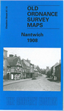
    This detailed map covers the small town of Nantwich, just SW of its newer but now larger neighbour, Crewe. Most of the town is covered, and features include the railway with Nantwich station, Market Drayton Junction, Shropshire Union Canal, Shrewbridge Hall Farm, Parkfield House, Wrights Almshouses, Hospital Street, Elm House, Nantwich Mill, Wych House Bank, Snow Hill, clothing manufactory, St Mary's church, chapels, High Street, Dovehouse Croft, Wilbraham's Almshouses, Nantwich Aqueduct, Marsh Farm (at west edge of map), River Weaver etc. A commercial directory of Nantwich in 1897 is included on the reverse.


  • Follow this link for a complete list of our Cheshire maps.
  • You can order maps direct from our On-line Mapshop. For other information and prices, and other areas, go to The Index Page.
  • Maps in the Godfrey Edition are taken from the 25 inch to the mile map and reduced to about 15 inches to the mile. For a full list of maps for the North West, return to the North West page.
    The Godfrey Edition / sales@alangodfreymaps.co.uk / 27 January 2018