 Here are the details of maps for Crewe Green:

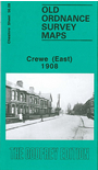
This detailed map covers the eastern side of Crewe, including most of the railway station. From the station, coverage extends eastward to Crewe Green and the Oakland Avenue part of Haslington. Other features include Alexandra Athletic Grounds, Crewe Arms Hotel, Manchester Bridge, Crewe Mill, Crewegate Farm, Tollgate Farm, St Michael's church. On the reverse we include about half of the earlier 1876 edition, showing the station area at that time.
The map links up with sheet 56.07 Crewe to the west