

Here are the details of maps for Crewe:
These three maps give very detailed coverage of Crewe, including the town, the railway station and much of the railway works.
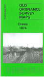
The 1874 version is double-sided for maximum coverage. The main map covers the town, with coverage from Beech Street southward to Nantwich Road, and westward to Coppenhall Heys. Features include the LNWR Steel Works, Old Works, The Valley, Market Square area, engine sheds etc. On the reverse we include the western part of sheet 56.08, extending coverage eastward to include the railway station, Manchester Bridge and Crewe-gate Farm
For 1908 we cover the town in 2 maps. Sheet 56.07 covers the town centre, with coverage from Beech Street southward to Nantwich Road, and westward to Queen's Park. Features include LNWR Crewe Works and much of Central and South Wards. Sheet 56.08 Crewe East covers the railway station area and gives extended coverage east to Crewe Green.
Note that the two 1908 maps also include sections of the early 1874 maps on the reverse. Because of this you may not need to purchase both the 1874 and 1908 versions.
Follow this link for a list of our maps for Cheshire or here for a general list for the North West.
You can order maps direct from our On-line Mapshop. For other information and prices, and other areas, go to The Index Page.
Maps in the Godfrey Edition are taken from the 25 inch to the mile map and reduced to about 15 inches to the mile. For a full list of maps for England, return to the England page.
Alan Godfrey Maps, Prospect Business Park, Leadgate, Consett, Co Durham, DH8 7PW / tel 01207-583388 / godfreyedition@btinternet.com / 20 October 2011