Old Ordnance Survey Maps of Disley North


We have published more than 2,000 in our series of Old Ordnance Survey Map reprints, including a large group in Lancashire & Cheshire. The maps are highly detailed. They are taken from the OS 1:2,500 (or 25 inch) maps and reduced to about 15 inches to the mile. Each covers an area of a mile and a half by a mile. They show streets with individual houses, tram tracks, railway tracks and even signals, factories, wharves and such details as fountains and water troughs. They will provide hours of fascination for historians and genealogists. The maps are neatly folded and each includes a specially written introduction to the area. Maps can be purchased on our On-line Mapshop where further information about titles is given. Or visit The Index Page for a full list to the series and details of Prices.


Here are the details of maps for Disley (North):

  • Cheshire Sheet 20.10 Disley (North) & High Lane 1907 - published 2007; intro by Chris Makepeace

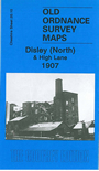
    This detailed map covers the largely rural area north of Disley. The eastern part of High Lane is included, including St Thomas church. Other features include Jacksonedge Quarry, Disley Golf Course, Windlehurst Mill, Windlehurst House, Wybersley Hall, Dove House, Stanley Hall, Stanleyhall Wood, part of Peak Forest Canal. The railway's Disley Tunnel runs through the map. We include directories for Disley and High Lane on the reverse.

    The map links up with sheet 20.14 Disley to the south.


    Follow this link for a complete list of our Stockport area maps.

    You can order maps direct from our On-line Mapshop. For other information and prices, and other areas, go to The Index Page.


    Maps in the Godfrey Edition are taken from the 25 inch to the mile map and reduced to about 15 inches to the mile. For a full list of maps for the North West, return to the North West page.

    The Godfrey Edition / godfreyedition@btinternet.com / 9 July 2008