We have published more than 2,500 in our series of Old Ordnance Survey Map reprints, including a large group in Lancashire & Cheshire. The maps are highly detailed. They are taken from the OS 1:2,500 (or 25 inch) maps and reduced to about 15 inches to the mile. Each covers an area of a mile and a half by a mile. They show streets with individual houses, tram tracks, railway tracks and even signals, factories, wharves and such details as fountains and water troughs. They will provide hours of fascination for historians and genealogists. The maps are neatly folded and each includes a specially written introduction to the area. Maps can be purchased on our On-line Mapshop where further information about titles is given. Or visit The Index Page for a full list to the series and details of Prices.
Here are the details of maps for Rosehill:
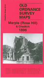
This detailed map covers the western part of Marple that includes Rose Hill (or Rosehill) station, Rosehill Brick Works, Marple Hall, Marple Wood. Coverage extends westward to Offertongreen, Dooleylane, Otterspool Bridge. This was a rural area, with Marple Hall the dominant building. The River Goyt curves through the map and the Chadkirk Print Works is at the top of the map. A directory of Marple in 1898 is included on the reverse.
The map links up with Cheshire sheet 11.13 Romiley to the north, 19.04 Offerton to the west and 20.02 Marple to the east.
Follow this link for a complete list of our Stockport area maps.
You can order maps direct from our On-line Mapshop. For other information and prices, and other areas, go to The Index Page.
Maps in the Godfrey Edition are taken from the 25 inch to the mile map and reduced to about 15 inches to the mile. For a full list of maps for the North West, return to the North West page.
The Godfrey Edition / godfreyedition@btinternet.com / 6 Feb 2011