
 Here are the details of maps for Hazel Grove:

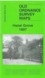
This detailed map covers most of the village of Hazel Grove, just south of Stockport. The map shows a linear village, stretching along the London Road, with coverage stretching from Southwood Street southward to St Thomas church. Features include Torkington House, railway with station, Torkington Lodge, Wellington Mill, Bosdenfold Cottages, Bramhall Moor, Bramhall House, Hazelgrove Mills, Steppinghill, tramway, Wood's Moor etc. On the reverse we include directories of Hazel Grove and Norbury, plus a railway timetable for the Manchester-Buxton line in 1897.
The map links up with Cheshire sheet 19.04 Offerton to the north, 19.07 Bramhall Grange to the west..