Old Ordnance Survey Maps of Altrincham (N)


We have published more than 2,500 maps in our series of Old Ordnance Survey Map reprints, including a large group in Lancashire and Cheshire. The maps are highly detailed. They are taken from the OS 1:2,500 (or 25 inch) maps and reduced to about 15 inches to the mile. Each covers an area of a mile and a half by a mile. They show streets with individual houses, tram tracks, railway tracks and even signals, factories, wharves and such details as fountains and water troughs. They will provide hours of fascination for historians and genealogists. The maps are neatly folded and each includes a specially written introduction to the area. Maps can be purchased on our On-line Mapshop where further information about titles is given. Or visit The Index Page for a full list to the series and details of Prices.


Here are the details of maps for Altrincham (N):

  • Cheshire Sheet 18.02 Altrincham (North) & Broadheath 1897 - published 2002; intro by Chris Makepeace. ISBN.978-1-84151-416-1

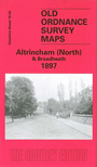
    This detailed map covers the northern part of Altrincham, Broadheath and parts of Timperley. Coverage stretches from St George's church and Woodlands Road northward to Timperley station. Features include Oldfield Nursery, Oldfield Hall, St George's church, railway with engine shed, Woodlands Park, Stamford House, Townfield House, Brookside Tannery, Atlantic Works, Linotype Works, LNWR line with Broadheath station, railway junctions, West Timperley station, Timperley station, Skelton Loop Line, Smith's Bridge, Riddings Hall, Pickering Lodge etc. On the reverse we include a selection of street directory entries, including Barrington Road, Bridgewater Road, Brook Lane, Burlington Street, Church Street, Manchester Road, Navigation Road.

    The map links up with Cheshire Sheet 9.14 Sale SW to the north, 18.03 Timperley to the east, 18.06 Altrincham to the south.


    Follow this link for a complete list of our Trafford maps.

    You can order maps direct from our On-line Mapshop. For other information and prices, and other areas, go to The Index Page.


    Maps in the Godfrey Edition are taken from the 25 inch to the mile map and reduced to about 15 inches to the mile. For a full list of maps for the North West, return to the North West page.

    The Godfrey Edition / godfreyedition@btinternet.com / 3 Feb 2011