
 Here are the details of maps for West Kirby:

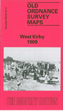
This detailed map covers the Wirral seaside town of West Kirby with coverage extending from West Kirby (Wirral Railway) station southward to King's Drive. Features include The Old Village, Kirby Park, Ashton Park, Marine Lake, LNWR & GW Jt Railway with Kirkby Park station, Manor House (at foot of map), Hilbre House, Grange, Grange Hall, Abbey Manor, Calday Grange Grammar School, West Kirby Hydro Hotel etc. On the reverse we include a portion of adjacent sheet 12.15, extending coverage south to include part of Caldy. Also extracts from a street directory for Caldy Village, Grange Road, Meols Drive, Village Road.
The map links up with Cheshire sheet 12.07 Hoylake-cum-Kirby to the north.