
 Here are the details of maps for Brightlingsea:

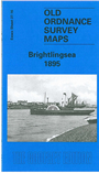
This detailed map covers the centre of Brightlingsea and the area east and north. Features include the High Street, Lower Green, New Street, Sidney Street, Water Side, Queen Street, Spring Grove Farm, Park Road, Park Chase, St James's church, Station Road (but only the eastern end of the station), Hurst Green, Eastend Green, windmill, saltings and many oyster pits. On the reverse we include extracts from an 1895 directory, including the commercial entry, while Harry Carmichael's introduction helps make this map an essential title for the student of Essex history.
Maps in the Godfrey Edition are taken from the 25 inch to the mile map and reduced to about 15 inches to the mile. For a full list of maps for England, return to the England page.
Alan Godfrey Maps, Prospect Business Park, Leadgate, Consett, Co Durham, DH8 7PW / sales@alangodfreymaps.co.uk / 25 November 2017