Old Ordnance Survey Maps of Bedfordshire

  • These detailed maps normally cover an area of about one and a half miles by one mile. Each map includes an introduction.
  • They are available through our On-line Mapshop

  • Here are the details of maps for Shefford:

  • Bedfordshire Sheet 22.12 Shefford 1900 - published 1995. ISBN.978-0-85054-756-6

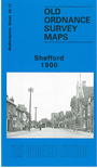
    This detailed map of Shefford is double-sided for maximum coverage. The main map shows shows most of Shefford and part of Clifton and includes the Railway Line and Station, Gas Works, St George's RC Chapel, North and South Bridge, St Michaels Church, Railway Inn, Shefford Mill, Sydney House and Three Horseshoes Public House. The area around Clifton includes Pedley Farm, The Grange, Clifton Lodge, Golden Lion Public House and the School. On the reverse we include the area to the west of Shefford which includes All Saints' Church, Manor House, Victoria Terrace and Campton Plantation.


  • Follow this link for a complete list of our Bedfordshire maps.
  • You can order maps direct from our On-line Mapshop. For other information and prices, and other areas, go to The Index Page.
  • Most maps in the Godfrey Edition are taken from the 25 inch to the mile map and reduced to about 15 inches to the mile. For a full list of maps for England, return to the England page.
    The Godfrey Edition / sales@alangodfreymaps.co.uk / 22 January 2018