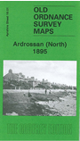
Ayrshire Sheet 16.01 Ardrossan (North) 1895 - published 2009; intro by Gilbert Bell. ISBN.978-1-84784-290-9 
This detailed map covers the northern part of Ardrossan. Features include the north half of Glasgow Street, Ardrossan North station, engine shed and approaches, Eglinton Street, North Crescent,
cemetery, Parkhouse Reservoir, Whitelees Reservoir, stretch of GSWR railway north of Parkhouse Junction.
The map links up with Ayrshire sheet 16.05 Ardrossan South to the south.
Follow this link for a complete list of our Ayrshire maps.
You can order maps direct from our On-line Mapshop.
For other information and prices, and other areas, go to The Index Page.
Maps in the Godfrey Edition are taken from the 25 inch to the mile map and reduced to about 15 inches to the mile.
For a full list of maps for Scotland, return to the Scotland page.
The Godfrey Edition / sales@alangodfreymaps.co.uk / 15 November 2016

 Here are the details of maps for Ardrossan (North):