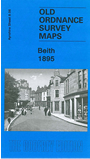
Ayrshire Sheet 8.06 Beith 1895 - published 2009; intro by Gilbert Bell. ISBN.978-1-84784-325-8 
This detailed map covers the small Ayrshire town of Beith, with coverage extending eastward to Gateside.
Features include town centre shown in detail with individual buildings all neatly delineated; railway terminus, churches, Bath Well Tannery, Bath Lane Tannery, net factory, cabinet works, Beith Cabinet Works,
Victoria Works, Crummock Park, Grangehill, Spier's School (at foot of map), Gateside Bridge, Bogside Bridge, Crummock House etc
Follow this link for a complete list of our Ayrshire maps.
You can order maps direct from our On-line Mapshop.
For other information and prices, and other areas, go to The Index Page.
Maps in the Godfrey Edition are taken from the 25 inch to the mile map and reduced to about 15 inches to the mile.
For a full list of maps for Scotland, return to the Scotland page.
The Godfrey Edition / sales@alangodfreymaps.co.uk / 15 November 2016
 Here are the details of maps for Beith: