We have published more than 1,900 maps in our series of Old Ordnance Survey Map reprints, including groups in Hampshire and Wiltshire. The maps are highly detailed. They are taken from the OS 1:2,500 (or 25 inch) maps and reduced to about 15 inches to the mile. Each covers an area of a mile and a half by a mile. They show streets with individual houses, tram tracks, railway tracks and even signals, factories, wharves and such details as fountains and water troughs. They will provide hours of fascination for historians and genealogists. The maps are neatly folded and each includes a specially written introduction to the area. Maps can be purchased on our On-line Mapshop where further information about titles is given. Or visit The Index Page for a full list to the series and details of Prices.
Here are the details of maps for Andover:
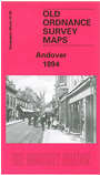
This detailed map covers the town centre of Andover, and extends about a mile west into open country. The railway main line runs through the top of the map, while the Andover & Redbridge branch loops through the town. Both Andover Junction and Town stations are included. Other features include Pitt's Mill, Workhouse, New Town, Bridge Street, High Street, St Mary's church, Market Place, Town Hall, New Street, fever hospital, Chantry Street, cemetery, Salisbury Road, Weyhill Road. On the reverse we include the commercial entry from the 1899 directory, listing the many businesses in the town.
Follow this link for a complete list of our Hampshire Series maps.
You can order maps direct from our On-line Mapshop. For other information and prices, and other areas, go to The Index Page.
Maps in the Godfrey Edition are taken from the 25 inch to the mile map and reduced to about 15 inches to the mile. For a full list of maps for the South West, return to the South West page.
The Godfrey Edition / godfreyedition@btinternet.com / 14 February 2006