Old Ordnance Survey Maps of Buckinghamshire

  • These detailed maps normally cover an area of about one and a half miles by one mile. Each map includes an introduction.
  • They are available through our On-line Mapshop

  • Here are the details of maps for Amersham:

  • Buckinghamshire Sheet 43.05 Amersham 1897 - published 1994; intro by Elizabeth Lockwood. ISBN.978-0-85054-663-7

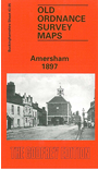
    This detailed map covers the 'old town' of Amersham, shortly before the great changes brought by the Metropolitan Railway. The station, opened in 1892, is in the NE corner, some distance from the town which is centred on the High Street. Features here include St Mary's church, Workhouse, Town Hall, malthouse, Crown Farm, Bury Farm, River Misbourne, brewery, cemetery, Whielden Street. To the east is Bury End, with Bury Mill, but otherwise Amersham appears as a small country town. A 1903 directory of Amersham is on the reverse.


  • Follow this link for a complete list of our Buckinghamshire or Milton Keynes maps.
  • You can order maps direct from our On-line Mapshop. For other information and prices, and other areas, go to The Index Page.
  • Most maps in the Godfrey Edition are taken from the 25 inch to the mile map and reduced to about 15 inches to the mile. For a full list of maps for the Buckinghamshire region, return to the Thames & Chilterns page
    The Godfrey Edition / sales@alangodfreymaps.co.uk / 27 January 2018