We have published more than 2,400 maps in our series of Old Ordnance Survey Map reprints; this includes more than 150 in Scotland. The maps are highly detailed. They are taken from the OS 1:2,500 (or 25 inch) maps and reduced to about 15 inches to the mile. Each covers an area of a mile and a half by a mile. They show streets with individual houses, tram tracks, railway tracks and even signals, factories, wharves and such details as fountains and water troughs. They will provide hours of fascination for historians and genealogists. The maps are neatly folded and each includes a specially written introduction to the area. Maps can be purchased on our On-line Mapshop where further information about titles is given. Or visit The Index Page for a full list to the series and details of Prices.
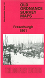
Here are the details of maps for Fraserburgh:
This detailed map is double-sided for maximum coverage.
The main map covers the town centre, with coverage extending southward to Victoria Street. Features include Outer Harbour, Balaclava Harbour, North and South Harbours, Lackie Head, Kinnairds Head, station, Custom House, Saltoun Square, The Hexagon, Broadsea area, Broadsea Shore, Town Hall, etc.
On the reverse we include part of adjacent sheet 3.05 extending coverage south to include Derbyhall, railway approaches, Coastguard Station, St Modan's Gate.
Follow this link for a complete list of our Aberdeenshire maps.
You can order maps direct from our On-line Mapshop. For other information and prices, and other areas, go to The Index Page.
Maps in the Godfrey Edition are taken from the 25 inch to the mile map and reduced to about 15 inches to the mile. For a full list of maps for Scotland, return to the Scotland page.
The Godfrey Edition / godfreyedition@btinternet.com / 7 December 2010